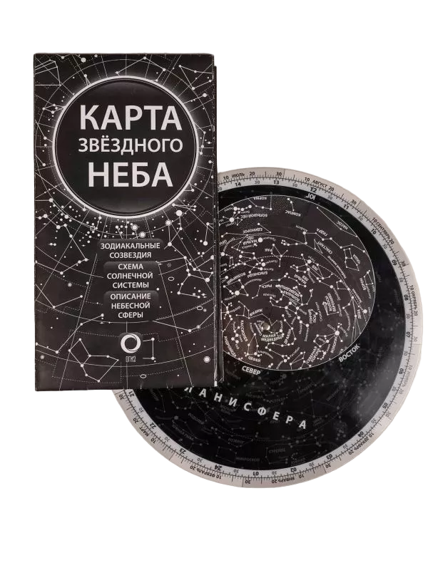
Star Sky Map and Planisphere
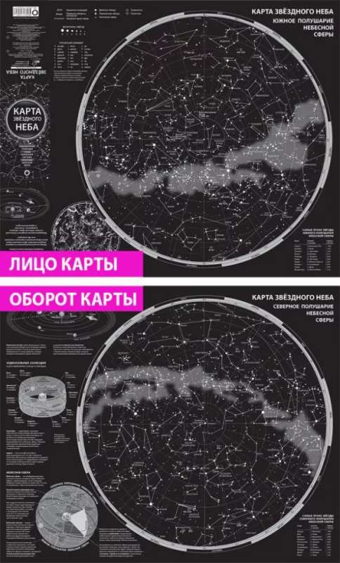
Set consisting of a map and a planisphere. Star sky map: A foldable double-sided map measuring 790x640 mm. The starry sky is shown as maps of the northern and southern hemispheres of the celestial sphere. This is how the night...
sky with flickering galaxies, nebulae, and star clusters can be seen from the North and South Poles of the Earth. The stars on the map are ranked by apparent magnitude. The names of the brightest stars and the conventional outlines of all 88 constellations are provided. Brief information about the Solar System, celestial sphere, star coordinates, ecliptic, and zodiac circle is given. Star sky planisphere: With its help, you can determine which stars and constellations are visible in the sky at any date and time of day, as well as establish the approximate position of the Sun in its annual movement along the ecliptic. The planisphere map shows stars up to the 5th apparent magnitude in a declination range from +90 to -50 degrees. To see the section of the night sky visible in your area, it is enough to orient yourself by the cardinal directions and, by rotating the movable disk, set the desired date and time for observations.
Brand: AST
Series: How to Observe Stars
Age restrictions: 12+
Year of publication: 2024
EAN: 9785171628086
Size: 256x320x6 mm
Weight: 109 g
ID: 1647713
In stock
€ 7.59
Will be delivered to United States on 14 July (Tu):
By courier
from € 38.94
Bestsellers


€ 5.19
In stock


€ 14.99
In stock


![[НЕ]ВЕРНОСТЬ. Что делать, когда не знаешь, что делать](https://mnogoknig.com/storage/media/372416/a9a59434-4a89-40ec-835d-0286347946cb.gif)