The Theater of the World
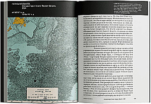
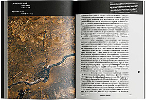
The world became a theater long before the theater itself, and especially before Shakespeare's ‘Globe’, precisely in that wondrous moment when a person saw fields, roads, and houses from a bird's-eye view and depicted them on stone in reduced scale....
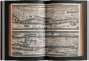
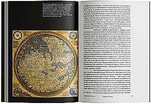
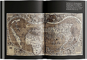
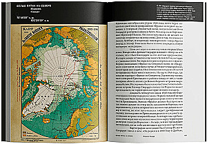
Thus appeared the first map on Earth, two and a half thousand years ago, engraved on a rock in the Camonica Valley. A richly illustrated book by a Norwegian explorer offers a fascinating history of cartography, guiding us along the entire path from the mysterious symbols of early humans to the Google Earth project, to show how the ability to represent what the world looks like evolved in parallel with its exploration. Each chapter seems to reveal to us the stage on which amazing scenes unfold: the dramatic search for the Northwest Passage, the mysterious Panotian Islands, 'where people cover their completely naked bodies with their own ears', the unexpected discovery of the Mid-Atlantic Ridge and the drifting of continents, the adventures of the ‘V-2’ rocket, culminating in the emergence of the satellite ‘Transit’ and GPS. But no matter how the world presents itself to humanity—Ptolemaic or Copernican, carved on a mammoth tusk or digitized in our mobile phone—it never ceases to captivate and allure us with its endless mysteries. As centuries ago, today, thanks to maps (which have become tactile and digital), we not only find the way we need or order pizza but also unlock our planet, our history, and, of course, new roles.
Author: Томас Рейнертсен Берг
Printhouse: Ad Marginem
Age restrictions: 16+
Year of publication: 2023
ISBN: 9785911037048
Number of pages: 320
Size: 240х165х25 mm
Cover type: soft
Weight: 420 g
ID: 1698094
In stock
€ 13.69
Will be delivered to United States on 8 July (We):
By courier
from € 38.94
Bestsellers


€ 5.19
In stock


€ 9.29
In stock
Choice. On the Freedom and Inner Strength of a Person
Эдит Ева Эгер, Эсме Швалль-Вейганд